Alum Cave Bluffs trail
About the Alum Cave Bluffs Trail
This moderately difficult hike is 4.6 miles round trip or 5.1 miles on to LeConte Lodge. The round-trip to the cave bluffs takes about 3 hours, but you should allow about 4 hours to LeConte Lodge. The Alum Cave trail is the most popular and well-known route to Mount LeConte.
The trail is dirt-packed and there are lots of plant and tree roots along this hike, so it’s not one of the most family friendly hikes in the mountains. There are a few steep sections along the hike as well, which could make the hike feel more strenuous, especially if you are making your way to Mount LeConte.
Alum Cave Trail Directions
From the Sugarlands Visitor Center, drive 8.6 miles east on Newfound Gap Road. There, you will find two parking areas where a gravel path leads to the beginning of a 2.3 mile hike to Alum Cave Bluffs.
Elevation of the Alum Cave Trail
You gain 2,600 feet on the way to 6,400 feet in elevation. When you gain elevation like this, it’s a good idea to have a light jacket or sweatshirt with you. Some hikers are able to recognize the elevation change based on the drop in temperature (even in the hot, summer months!).
Special Features Found Along the Alum Cave Bluffs
- Arch Rock
- 1993 summer storm damage
- Inspiration Point
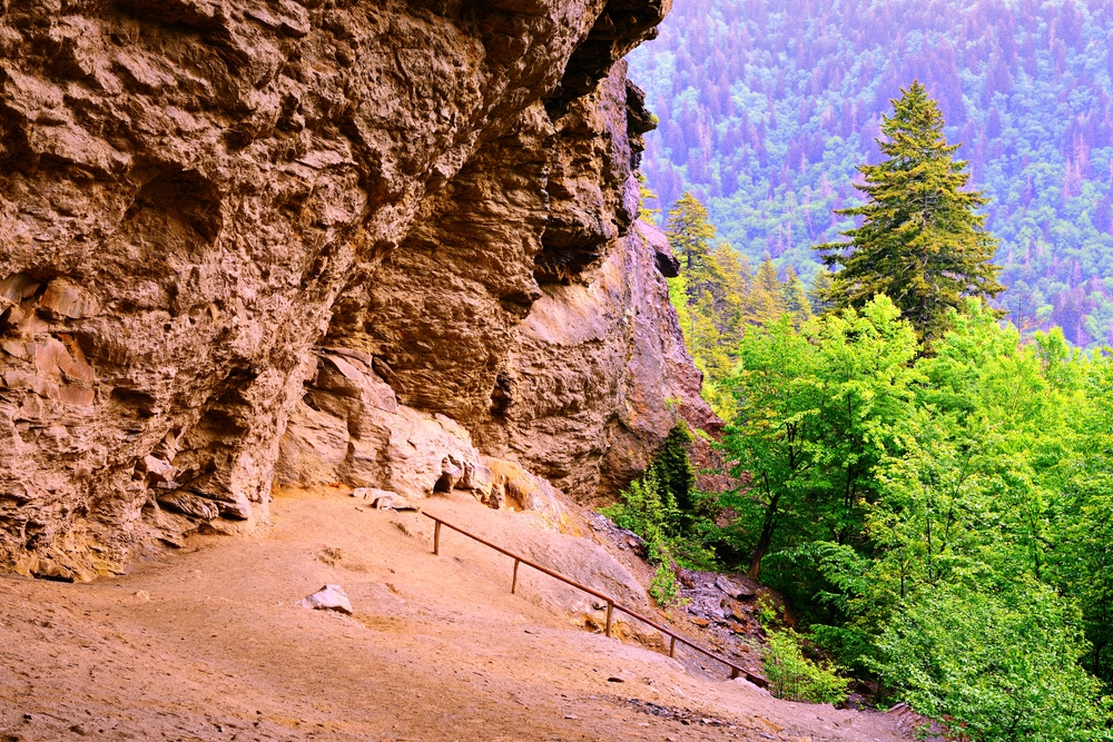
- Alum Cave Bluffs
Mother Nature’s majesty and power are clearly demonstrated in this 4.6 mile, round trip hike. The views are great, particularly if you go on to LeConte Lodge and Cliff Tops.
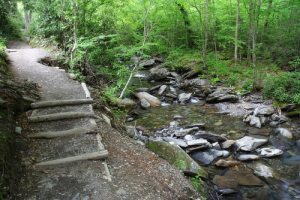
You’ll begin this hike at the Grassy Patch just off the parking area. Shortly after entering the forest, you will reach the Alum Cave Bluff Trail parallel the Alum Cave Creek for approximately a mile and then follow Styx Branch, a main tributary of Alum Cave Creek. A few hundred yards beyond this point, you’ll see the boulder and log remains of a 1993 flash flood and landslide on your left. A heavy thunderstorm dumped several inches of rain with a force so great that huge boulders were exposed and tossed–its path is clear to the hiker and will remain so for years. At mile 1.5, you come to Arch Rock, where a set of stone stairs aids your passage through one of the few natural arches inside the park. At the 1.8 mile mark, you will come upon Inspiration Point, affording the first panoramic view of the area. Thereafter, you’ll pass through an area of low shrubs, and shortly thereafter, arrive at Alum Cave Bluff (mile 2.3). Alum Cave is not what the name implies. Its not a cave–rather it’s a jutting ledge of black slate forming out over the trail to give the impression of a cave. The name Alum Cave comes from the deposits of alum found along the “cave” walls.
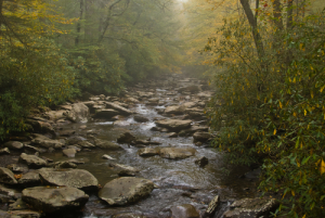
Alum Cave Creek
For the avid hikers who will continue on to LeConte Lodge, the trail curves up and around the bluff and begins following the ridge that forms the southern flank of Mount LeConte.
Two hundred yards from its finish at LeConte Lodge, the trail is joined from the left by the Rainbow Falls Trail. LeConte Lodge consists of several wood-shingled cabins, two lodges and a dining room. There is no electricity and water is pumped into holding tanks from a spring. The Lodge even uses llamas to haul in supplies. Reservations can be made at LeConte Lodge by calling (423) 429-5704. There’s usually quite a waiting list, so you’ll want to try to get in quite a while ahead of your visit.
Above the Lodge, you’ll find Cliff Top, one of the best vantage points in the Smokies–when the view is not covered by the misty, Smoky Mountain clouds.