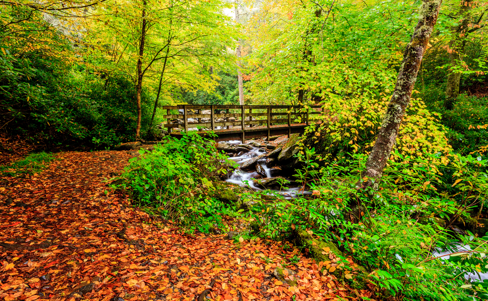
One of the most interesting trails in the Great Smoky Mountain National Park is Old Settlers Trail. Its historical OST Trail marker landmarks set it apart from most other trails. It is less rocky and smoother than many other trails. Add to these points its biological diversity and you have three distinguishing features. The trail may be accessed in the Greenbrier area approximately 12.3 miles from Cosby or about 4 miles from Gatlinburg. Or, it may be accessed 1.2 miles up Albright Grove trail, which is about 2.3 miles west of Cosby, Tennessee, on state road 321. At that point turn toward the GSMNP onto Baxter Rd. Drive through a quaint mountain subdivision of cabins to Laurel Springs Road; then turn right and drive a few hundred yards until you see a gated gravel road on the left. Parking is permitted along the road so long as you do not block the gated entrance. Another, lesser known, entrance exists near Steiner Bell Lodge parking lot, which is about 13 miles from Cosby and about 1/2 mile up a narrow driveway leading to the Lodge. Next to the left side of the parking lot the trail begins. It descends about 700 yards down to a marshy area where there is a post-marker. An old cemetery exists beyond the field to the right, up on a hill. But, the trail to OST goes left and leads to another post-marker and Old Settlers Trail – hereafter OST. The following descriptions will take us on a hike east from the Greenbrier area of the GSMNP. This Park entrance is about 4 miles east...
About the Chimney Tops Trail Although only two miles in length (4 miles round trip), the Great Smoky Mountains National Park trail to Chimney Tops requires strength and caution. Nevertheless, due to the excellent views from this trail, as well as abundant wildflowers, streams and large trees, many feel a hike up to “the chimneys” is well worth the extra effort. Over time, the Chimney Tops trail has become one of the Great Smoky Mountain National Park’s most popular hiking trails. Chimney Tops Trail Directions To reach the Chimney Tops trailhead from Gatlinburg, take Newfound Gap Road into the park. Newfound Gap Road is the only road which completely traverses the Great Smoky Mountain National Park, linking Cherokee NC to Gatlinburg TN. From the Sugarlands Visitor Center, continue 6.7 miles until you reach the parking lot at the Chimney Tops trailhead. The parking lot and trailhead is located between the lower tunnel and “the loop” on Newfound Gap Road. If traveling from Cherokee to Chimney Tops, take the Newfound Gap Road about 22 miles from the Oconaluftee Visitor Center in North Carolina. Elevation on the Chimney Tops Trail Once at the trailhead, there is plenty of room for parking, but the trail itself is sometimes a bit crowded due to its popularity. A tour bus in the parking lot means more people on the trail, so if you are looking for a back-to-nature experience along this trail, you may enjoy a hike to Chimney Tops during off-season. If so, beware of ice in really cold weather, as the trail is steep, rising 1,300 feet from the trailhead to the chimney-like pinnacles...
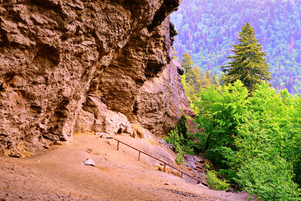
About the Alum Cave Bluffs Trail This moderately difficult hike is 4.6 miles round trip or 5.1 miles on to LeConte Lodge. The round-trip to the cave bluffs takes about 3 hours, but you should allow about 4 hours to LeConte Lodge. The Alum Cave trail is the most popular and well-known route to Mount LeConte. The trail is dirt-packed and there are lots of plant and tree roots along this hike, so it’s not one of the most family friendly hikes in the mountains. There are a few steep sections along the hike as well, which could make the hike feel more strenuous, especially if you are making your way to Mount LeConte. Alum Cave Trail Directions From the Sugarlands Visitor Center, drive 8.6 miles east on Newfound Gap Road. There, you will find two parking areas where a gravel path leads to the beginning of a 2.3 mile hike to Alum Cave Bluffs. Elevation of the Alum Cave Trail You gain 2,600 feet on the way to 6,400 feet in elevation. When you gain elevation like this, it’s a good idea to have a light jacket or sweatshirt with you. Some hikers are able to recognize the elevation change based on the drop in temperature (even in the hot, summer months!). Special Features Found Along the Alum Cave Bluffs Arch Rock 1993 summer storm damage Inspiration Point Alum Cave Bluffs Mother Nature’s majesty and power are clearly demonstrated in this 4.6 mile, round trip hike. The views are great, particularly if you go on to LeConte Lodge and Cliff Tops. You’ll begin this hike at the Grassy Patch just...
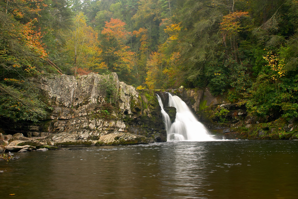
About the Abrams Falls Trail The Abrams Falls trail in Cades Cove is one of the most well-known waterfall hikes in the Smoky Mountains. The hike is moderate in difficulty and is a short 5 miles round trip. For beginner hikers, this trail is perfect! When you’re hiking Abrams Falls in Cades Cove, you should plan on spending about 3 hours of your day in the mountains (or a little longer if you plan to spend extra time admiring the waterfall). The trail is a little rocky and dirt-packed, so you’ll want to be sure to wear comfortable hiking shoes. This hike is alright for families, but if you have very small children, you may want to consider a shorter, nature trail since the trail may be too difficult for young children. Abrams Falls Directions From Gatlinburg, turn right at the Sugarlands Visitor Center onto Little River Road toward Cades Cove, where you will travel nearly halfway around the 11-mile loop road to the parking area for the 5-mile round-trip hike to Abrams Falls. From Townsend, you should take TN 321 to the national park entrance, turn right on Little River Road and head toward Cades Cove. To reach the Abrams Falls trailhead, you’ll need to drive along the one-way Cades Cove Loop Road approximately 5 miles, and turn right onto a gravel road that ends within 0.5 mile at a parking area. Signs mark the area well, but you should know you’ve gone too far if you get to the Cades Cove Visitors Center. The Abrams Falls trail begins at the wooden bridge at the end of the parking area. Since the...