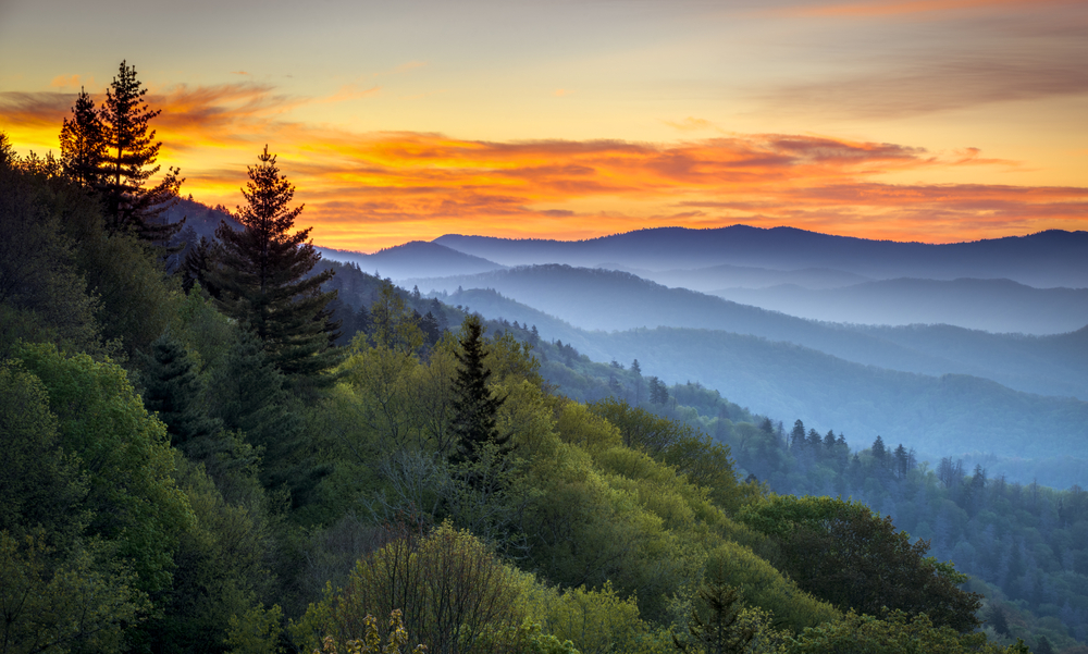
As the most visited national park in the country, the Great Smoky Mountains National Park is filled with all sorts of amazing things to see and do. While it is massive – 816 mi² to be exact – we want you to be excited about your adventure into the national park! That’s why we’ve put together the one and only Smoky Mountain National Park map and guide you’ll need for your visit. Print this handy guide or bookmark it on your phone, so you have it any time you visit the Smoky Mountains. You’ll have your map in-hand and adventure in your spirit, so you’ll be ready to go! It’ll take a few trips to see everything we’ve included here, so you better get started soon!
 Visitor Centers in the Great Smoky Mountains National Park
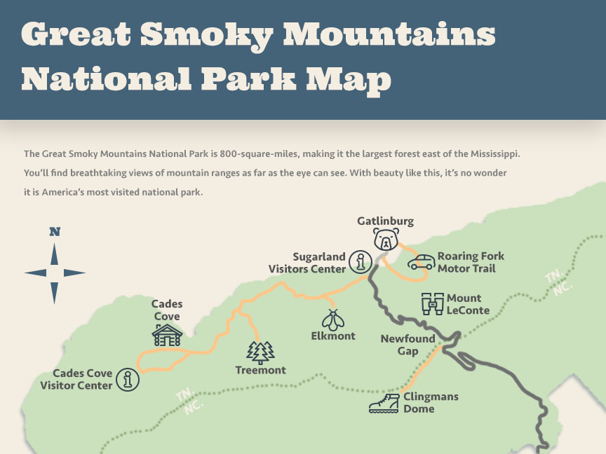
Sugarlands Visitor Center
Named for the abundance of sugar maple trees found when settlers arrived to the area in the early 19th century, Sugarlands Visitor Center is the best place to start your exploration of the Great Smoky Mountains National Park. The Visitor Center offers special programs including ranger-led activities, a free 20-minute film about the park, natural history exhibits and a store.
Located 2 miles south of Gatlinburg on US-441, Sugarlands Visitor Center is open every day except for Christmas. Their hours are as follows:
| Month(s) | Hours |
|---|---|
| January | 9:00 a.m. - 4:30 p.m. |
| February | 9:00 a.m. - 5:30 p.m. |
| March | 9:00 a.m. - 6:30 p.m. |
| April | 9:00 a.m. - 7:00 p.m. |
| May - July | 9:00 a.m. - 7:30 p.m. |
| August | 9:00 a.m. - 7:00 p.m. |
| September - October | 9:00 a.m. - 6:30 p.m. |
| November | 9:00 a.m. - 5:30 p.m. |
| December | 9:00 a.m. - 4:30 p.m. |
Once you’re touring the Cades Cove Loop Road, you’ll quickly realize one of the most popular stops the Cades Cove Visitor Center. You can purchase maps, books and postcards about Cades Cove and the national park as a whole. You can also find cornmeal and molasses from time to time.
Open every day except Christmas Day.
| Month(s) | Hours |
|---|---|
| January | 9:00 a.m. - 4:30 p.m. |
| February | 9:00 a.m. - 5:30 p.m. |
| March | 9:00 a.m. - 6:30 p.m. |
| April | 9:00 a.m. - 7:00 p.m. |
| May - July | 9:00 a.m. - 7:30 p.m. |
| August | 9:00 a.m. - 7:00 p.m. |
| September - October | 9:00 a.m. - 6:30 p.m. |
| November | 9:00 a.m. - 5:30 p.m. |
| December | 9:00 a.m. - 4:30 p.m. |
Great Smoky Mountains National Park Driving Tours
Roaring Fork Motor Trail
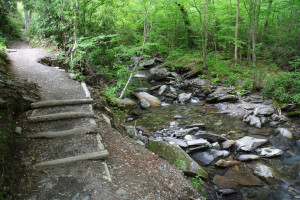
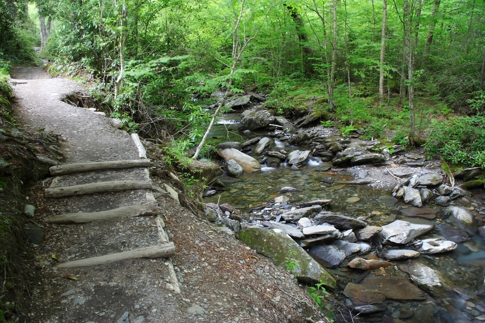
Named after the ferocity of the river that flows alongside it, Roaring Fork is one of the most popular driving tours in the Smokies. Roaring Fork is known for its beautiful scenery and historical intrigue, making it a popular site in the park. The 5-mile loop road is a quick trip, but you can expect to spend about two hours on your trip.
To get to Roaring Fork Motor Trail, turn at stoplight #8 from the 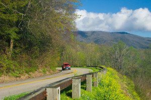 Parkway. You will follow Historic Nature Trail Road to the Cherokee Orchard entrance to the Great Smoky Mountains National Park.
Newfound Gap
The only road that completely traverses our Smoky Mountain National Park map, Newfound Gap Road runs 33 miles between Cherokee and Gatlinburg. This road has so much to offer – nature walks, hikes, mountain views and historic structures. Newfound Gap is also home to the Rockefeller Memorial, a popular destination in the park from where former U.S. President Franklin D. Roosevelt formally dedicated the park on Sept. 2, 1940, so make sure it’s also a stop on your itinerary.
Campbell Outlook
Named for Carlos Campbell, who wrote Birth of A National Park, Campbell Overlook is certainly not to be missed. As you continue along Newfound Gap Road, a little ov er two miles, you will find Campbell Overlook where you will see some of the most striking views in all of the Smokies.
6 More Important Stops on Our Great Smoky Mountain National Park Map
1) Elkmont
Known for great mountain camping now, Elkmont is a proud piece of Appalachian history, having served as the home of old pioneer communities, a logging town and now a resort community carefully protected by a strong sense of preservation and the national park movement.
2) Tremont
Situated alongside the Little River’s Middle Prong South of Townsend in Blount County, TN, Tremont is known for its known for its original settlers that consisted of robust pioneers and a logging community. While the name refers to Middle Prong’s entire watershed from Miry Ridge to the East and Defeat Ridge to the West, Tremont is now known best as the Great Smoky Mountains Institute at Tremont.
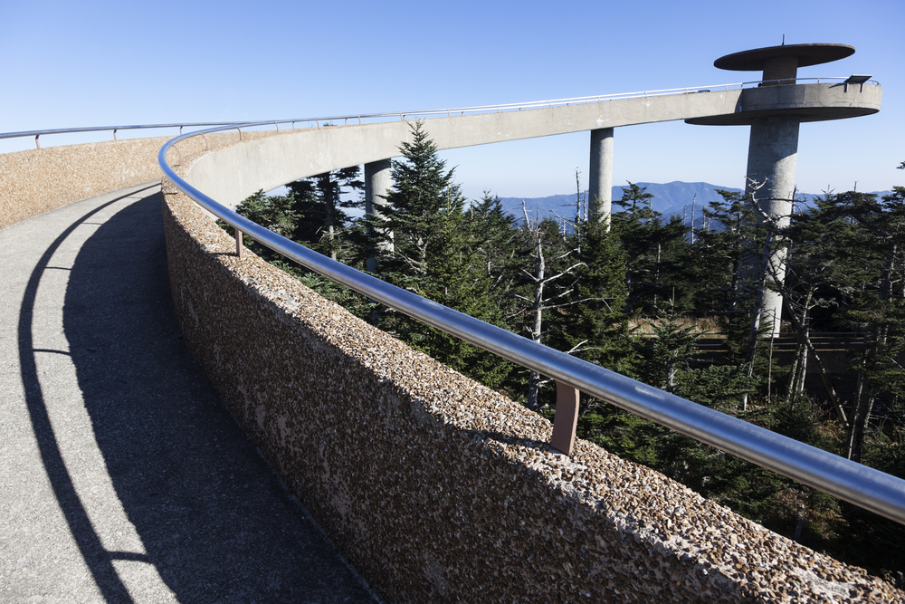
3) Clingmans Dome
As the highest point in the entire park at 6,623 feet, Clingmans Dome is a definite point of interest on our Great Smoky Mountain National Park map. From the summit’s observation tower, you’ll find breathtaking panoramic views of the Smokies that can extend for more than 100 miles. Try to be there at sunrise or sunset; the sight is nothing short of spectacular.
Located off Newfound Gap Rd. on the 7-mile Clingmans Dome Rd., this Smoky Mountain spot is a moderately difficult half-mile hike to the ramp of the observation tower at Clingmans Dome. It’s a bit tough, but it’s definitely worth the effort.
4) Mount LeConte
Next on our map of the national park is the third highest peak in the Smoky Mountains – Mount LeConte – and you’ll need to climb 2,763 feet to reach it. Five different trails will take you to the top – Alum Cave Trail, Boulevard Trail, Bullhead Trail, Rainbow Falls Trail and Trillium Gap Trail – with varying in difficulty, altitude climb and scenery. Both Alum Cave and Boulevard trails showcase stunning panoramic views and intriguing natural features, while Rainbow Falls and Trillium Gap present waterfalls and streams. Alternatively, Bullhead Trail is ideal for viewing wildflowers and observing the red, orange and yellow leaf color change in the fall.
Smoky Mountain National Park Directions to Mount LeConte:
- Alum Cave Trailhead – From the Sugarlands Visitor Center near Gatlinburg, drive South along Newfound Gap Road for 8.7 miles to reach the Alum Cave Trailhead.
- Boulevard Trailhead – From the Sugarlands Visitor Center near Gatlinburg, drive 13 miles South along Newfound Gap Road. You’ll see the Newfound Gap parking lot.
- Bullhead Trailhead – Starting from Light 8 in Gatlinburg, turn onto Historic Nature Trail / Airport Road. After driving 0.7 miles veer right onto Cherokee Orchard Road, upon which you’ll enter into Great Smoky Mountain National Park. After driving another 2.2 miles you’ll enter the one-way Cherokee Orchard Loop Road. After driving roughly 0.6 miles on the loop, the Bullhead Trailhead will be on your right.
- Rainbow Falls Trailhead – Starting from Light 8 in Gatlinburg, turn onto
 Historic Nature Trail /Airport Road. After driving 0.7 miles veer right onto Cherokee Orchard Road, upon which you’ll enter into Great Smoky Mountain National Park. After driving another 2.2 miles you’ll enter the one-way Cherokee Orchard Loop Road. After driving roughly 0.6 miles on the loop, the Rainbow Falls Trailhead will be located on your right.
- Trillium Gap Trailhead – Starting from Light 8 in Gatlinburg turn onto Historic Nature Trail/Airport Road. After driving 0.7 miles veer right onto Cherokee Orchard Road, upon which you’ll enter into Great Smoky Mountain National Park. After driving another 2.2 miles you’ll enter the one-way Cherokee Orchard Loop Road. Drive 0.9 miles on the loop before turning right onto the Roaring Fork Motor Nature Trail.
5) Cades Cove
Cades Cove is a place you’re certain to visit 50 times after your first trip, but you’ll never tire of it. Accessible by foot, bike or car, the pastoral and picturesque area is home to plenty of wildlife to observe and natural scenery that is perfect for photography buffs. Cades Cove is located in the Great Smoky Mountains National Park and is clearly marked.
6) Cable Mill Historic Area
You can find Cable Mill historic area and Cades Cove Visitor Center inside the park near the midpoint of the 11-mile, one-way Loop Road.
If you would like to learn more about the Great Smoky Mountain National Park or the historical structures and history found along the way, be sure to read up on Smoky Mountains National Park history.