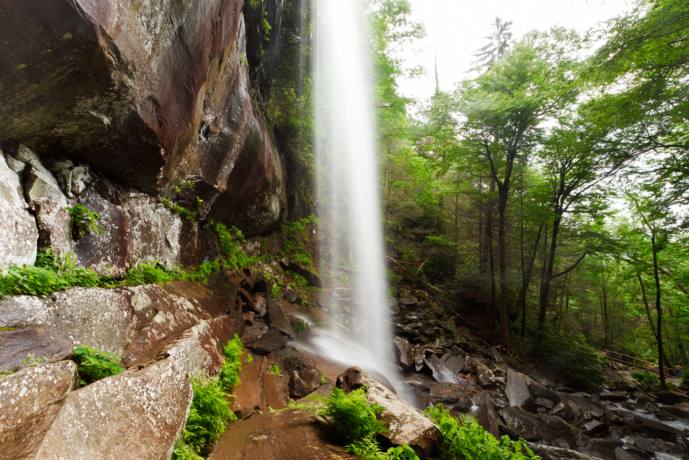
The Rainbow Falls Trail is one of several that will take you to the top of Mt. LeConte and is also the oldest or earliest route to LeConte. The trail can be challenging, but also offers an intermediate reward in that it affords the hiker a rest at the beautiful Rainbow Falls. Summary The Rainbow Falls Trail is fairly challenging if completed all the way to Mt LeConte. Allow an hour and a half to Rainbow Falls and four hours to Mt LeConte. Hikers will gain nearly 4,000 feet in elevation by the time they get to Mt. LeConte. Point of Departure Cherokee Orchard Road – Turn at light #8 in Gatlinburg and follow the Airport Road 1 mile out of Gatlinburg into the Great Smoky Mountains National Park. The name will change from Airport Road to Cherokee Orchard Road. About 2.5 miles after entering the Park, Cherokee Orchard Road approaches the Rainbow Falls parking area. You will find the trail head at one edge of the parking area. Features of Interest Your first reward comes at the 2.8 mile point when you arrive at Rainbow Falls. At the 6.6 mile point you will come upon an Alum Cave Trail junction which leads left 0.1 mile to the LeConte Lodge (the only lodging to be found within the Park), which is 6.7 miles from where you began. Overnights at LeConte Lodge require a reservation, which should be obtained weeks or even months in advance by calling (423) 429-5704. The Rainbow Falls Trail gains nearly four thousand feet in 6.7 miles, making it one of the more uniquely challenging climbs in...
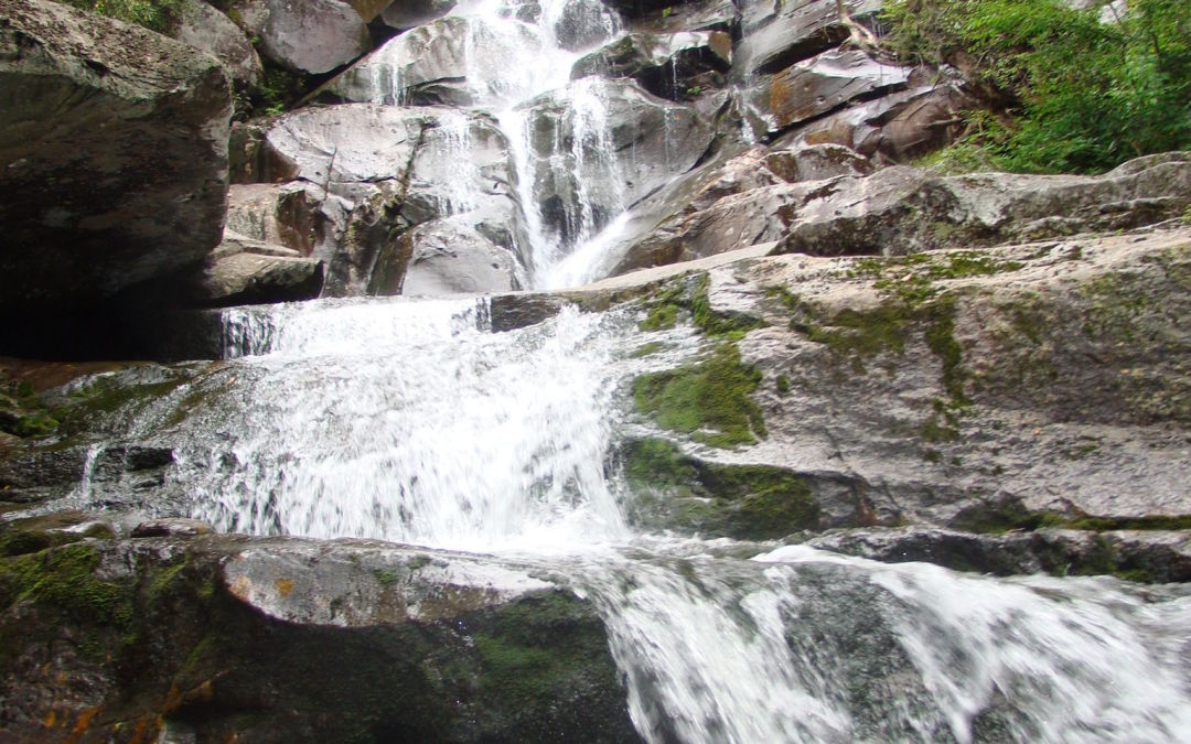
The rewards are great on this 8-mile round-trip hike in the Greenbrier section of the Park. The diligent hiker not only gets to enjoy the Ramsay Cascade falls—arguably the best waterfall in the Smokies—but also can view stands of old-growth trees which never suffered from the logger’s saw or the settler’s ax. Summary You have only to take this hike once to understand why it’s one of the most popular. The falls are ample reward not only for the hiker, but the artist and photographer as well. The trail starts out with a slight upgrade in the beginning, then becomes more challenging as you near the cascades. The latter portion of the trail is where you will find the old growth trees—some of which measure in record proportions. The round-trip is approximately 8 miles and can take a little over four hours, depending on whether you take children. Directions From Gatlinburg, drive east along US 321 (stop-light #3 in Gatlinburg) for approximately 6 miles. Turn right on Greenbrier Road and travel 3.1 miles along the Little Pigeon River to Greenbrier Cove. Turn left at Ramsay Prong Road and travel 1.5 miles to the parking area. The trail begins at the back of the parking area. Hike Details Your hike will start on the south side of the Middle Prong of the Little Pigeon River on the Ramsay Cascade Trail. You will cross the prong on a very long footbridge, and make your way past Ramsay Branch, which flows from Greenbrier Pinnacle on your left. At mile 1.5, the trail comes to a turnaround. The Greenbrier Pinnacle Trail turns off...
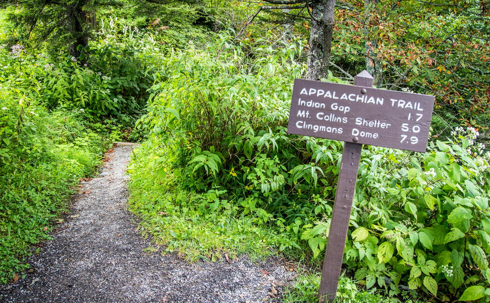
The Appalachian Trail meanders across the mountain tops of The Great Smoky Mountains National Park. Conceived in 1921 by Benton McKay and initially cleared and marked in 1923, the Appalachian Trail was completed in 1937 and is a marvelous tribute to the well-meaning individuals such as McKay who overcame many obstacles to create this splendid national treasure. The trail winds for 2,015 miles (actually it varies due to changes in sections of the trail) Appalachian Trail in the Great Smoky mountains through parts of 14 states. Its southern terminus is Springer, GA and ends (or begins, depending on your perspective) on Mount Katahdin in Maine. The Appalachian Trail in the Great Smoky Mountains The Trail (or AT as it is commonly called) includes a section 69 miles in length that serves as a boundary for Tennessee and North Carolina in the Great Smoky Mountains. A few hardy souls thru-hike the entire lengh of the AT each year (approximately 200 each year), but visitors to the Smokies can enjoy less challenging lengths of the Trail that are accessible from a few of the hiking trails that connect to the AT. One popular approach is to park at the Newfound Gap parking area (where you can also visit the memorial where Franklin D. Roosevelt dedicated the Great Smoky Mountains National Park). From the parking area, you can hike modest portions both north and south on the Trail. One popular destination is north to Charlies Bunion. From Charlies Bunion, fire clearings above steep mountain slopes afford spectacular views to peaks and valleys below. About every eight miles or so, the National Park...
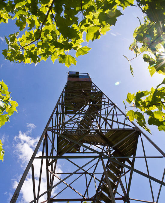
The historic fire towers of the Great Smoky Mountains National Park were once used to gain a bird’s eye view of the mountains in order to spot forest fires. Though many of the towers were removed as more modern methods for fire detection were developed, Shuckstack and three other towers remain. These out of the way destinations are well worth the extra effort, and the vistas they provide are by far better than any view available from any roadside overlook. Trail Details Length 6.8 miles roundtrip Difficulty Medium to Strenuous Highlights Excellent views of Fontana Lake and the Smokies Caution Steep terrain can be slick in snow or rain, or on fallen leaves Note Best hiked on a clear day to enjoy the view. Directions Shuckstack is on the North Carolina side of the Park. From Bryson, take NC 28 to Fontana Dam. Start your hike from the north side of the dam. Trail Description Located on Twentymile ridge, the Shuckstack fire tower is just a tenth of a mile from the Appalachian Trail and a mere 3.4 miles from the road. The quickest and easiest way to access the tower is to begin on the north side of Fontana Dam, which is on the North Carolina side of the Park. Please note that the dam is under renovation at this time, and vehicles are prohibited from crossing the dam. Foot traffic across the dam is allowed, however. The section of road you have to walk to reach the trailhead is nice and level, but it will add a little over a mile to the roundtrip distance of the...
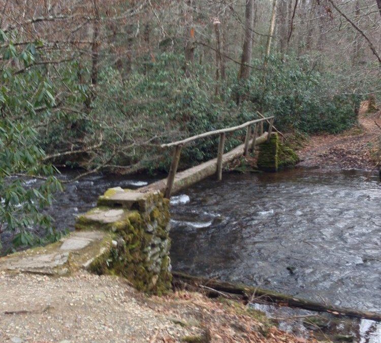
The Boogerman Trail Hike, first and foremost, takes you away from the traffic and population of the Tennessee side of the Great Smoky Mountains National Park. It takes a bit of trouble to get to Cataloochee (see the directions below), but I’ll bet my last dollar you’ll enjoy the Cataloochee area—and you’ll be back. Summary A moderately challenging 7.4 mile (round-trip) hike that takes you by some old growth forest, picturesque streams and falls, and the remains of early settler’s homesites. Plan on roughly three hours, depending on your pace and whether you have children along. The departure point is in the Cataloochee section (the North Carolina side), which is a little more difficult to get to, but well worth the effort. Elevation You will climb to approximately 800 feet to an altitude of 3,600 feet. Point of departure After following the directions from I-40, NC 276, and Cove Creek Road, navigate your way to the Caldwell Fork Trail (follow the signs). Boogerman Trail Loop The Boogerman Trail is named for Robert “Boogerman” Palmer, whose homesite you’ll pass as you complete this moderately challenging 7-mile loop trail, which can take between 2 and 3 hours to complete. You will gain nearly 850 feet on your way to 3,600 feet at the trail’s highest point. The trail is well maintained and this hike offers up views of some of the largest trees in the area, old homesites (including Palmer’s) and mountain streams. This area was spared from the logging operations which dominated much of the Smokies area before the land was purchased for the Park. After following the directions from...