Rather than enjoying the wonderful scenery of the Great Smoky Mountains National Park by hiking or auto touring, you can rent a bicycle and take a ride on the Smoky Mountains National Park biking trails with some of the best views. Biking is a different way to explore some of the great wildlife and nature the park has to offer. There are a few trails available for biking, and you will want to have a look for yourself while visiting these 3: Cades Cove Loop Cades Cove Loop is the most popular biking area this side of the Smoky Mountains. If you aren’t familiar with the area, you may not know there are not trails designated for biking within the park because of steep terrain, vehicle traffic and other hazards. However, Cades Cove Loop is the one exception. During the months the area has its most visitors, May through September, the park closes the loop to automobile traffic on Wednesdays and Saturday mornings, so bikers and those traveling on foot can enjoy Cades Cove up close. The loop is an 11 mile one-way road that has plenty of history, wildlife and nature to show. When biking the Cades Cove Loop, you will get to see some of the area’s first major settlements, and you will also have the chance to see some native animals, such as the white-tailed deer, up close. Even though it is one of the most popular sights to see in the area, keep in mind the 11 mile loop is somewhat strenuous, and could take 2-4 hours to complete on a bicycle. Gatlinburg Trail If...
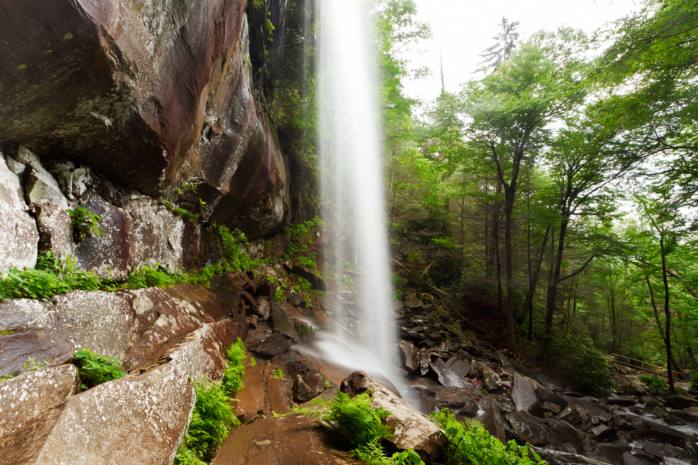
The Rainbow Falls Trail is one of several that will take you to the top of Mt. LeConte and is also the oldest or earliest route to LeConte. The trail can be challenging, but also offers an intermediate reward in that it affords the hiker a rest at the beautiful Rainbow Falls. Summary The Rainbow Falls Trail is fairly challenging if completed all the way to Mt LeConte. Allow an hour and a half to Rainbow Falls and four hours to Mt LeConte. Hikers will gain nearly 4,000 feet in elevation by the time they get to Mt. LeConte. Point of Departure Cherokee Orchard Road – Turn at light #8 in Gatlinburg and follow the Airport Road 1 mile out of Gatlinburg into the Great Smoky Mountains National Park. The name will change from Airport Road to Cherokee Orchard Road. About 2.5 miles after entering the Park, Cherokee Orchard Road approaches the Rainbow Falls parking area. You will find the trail head at one edge of the parking area. Features of Interest Your first reward comes at the 2.8 mile point when you arrive at Rainbow Falls. At the 6.6 mile point you will come upon an Alum Cave Trail junction which leads left 0.1 mile to the LeConte Lodge (the only lodging to be found within the Park), which is 6.7 miles from where you began. Overnights at LeConte Lodge require a reservation, which should be obtained weeks or even months in advance by calling (423) 429-5704. The Rainbow Falls Trail gains nearly four thousand feet in 6.7 miles, making it one of the more uniquely challenging climbs in...
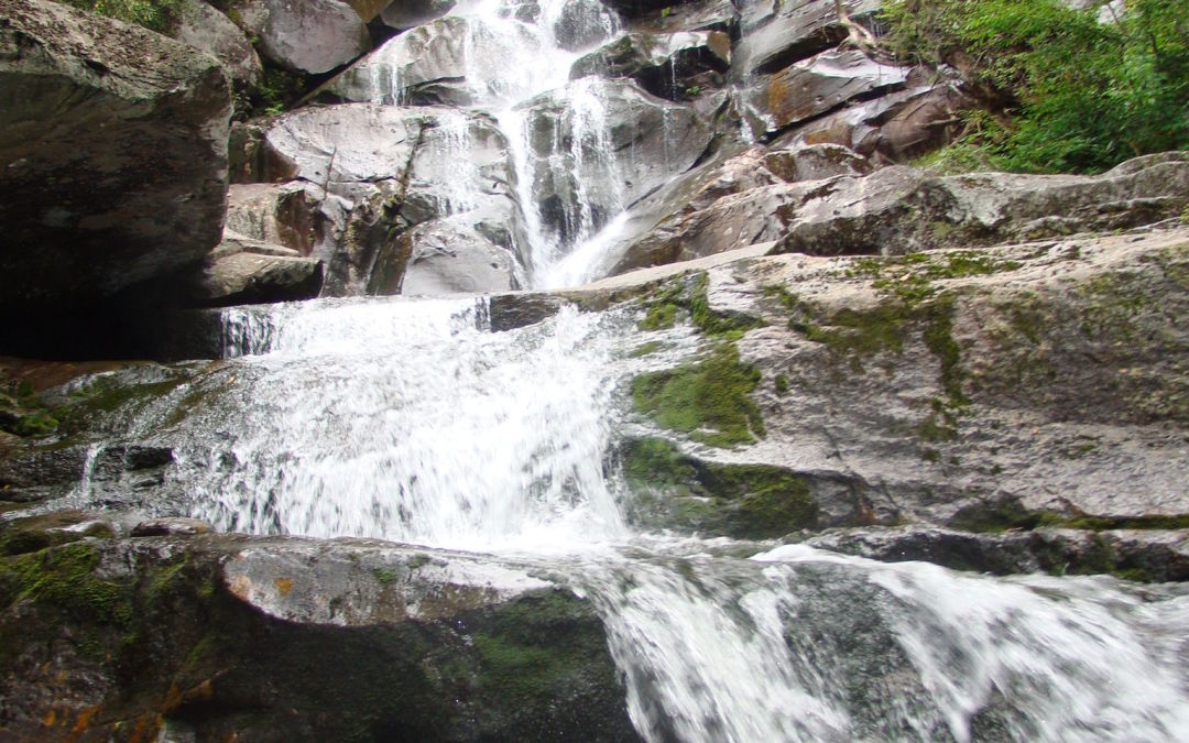
The rewards are great on this 8-mile round-trip hike in the Greenbrier section of the Park. The diligent hiker not only gets to enjoy the Ramsay Cascade falls—arguably the best waterfall in the Smokies—but also can view stands of old-growth trees which never suffered from the logger’s saw or the settler’s ax. Summary You have only to take this hike once to understand why it’s one of the most popular. The falls are ample reward not only for the hiker, but the artist and photographer as well. The trail starts out with a slight upgrade in the beginning, then becomes more challenging as you near the cascades. The latter portion of the trail is where you will find the old growth trees—some of which measure in record proportions. The round-trip is approximately 8 miles and can take a little over four hours, depending on whether you take children. Directions From Gatlinburg, drive east along US 321 (stop-light #3 in Gatlinburg) for approximately 6 miles. Turn right on Greenbrier Road and travel 3.1 miles along the Little Pigeon River to Greenbrier Cove. Turn left at Ramsay Prong Road and travel 1.5 miles to the parking area. The trail begins at the back of the parking area. Hike Details Your hike will start on the south side of the Middle Prong of the Little Pigeon River on the Ramsay Cascade Trail. You will cross the prong on a very long footbridge, and make your way past Ramsay Branch, which flows from Greenbrier Pinnacle on your left. At mile 1.5, the trail comes to a turnaround. The Greenbrier Pinnacle Trail turns off...
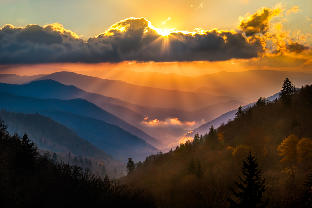
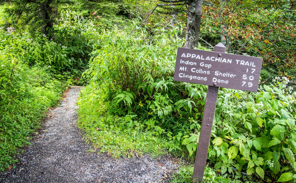
The Appalachian Trail meanders across the mountain tops of The Great Smoky Mountains National Park. Conceived in 1921 by Benton McKay and initially cleared and marked in 1923, the Appalachian Trail was completed in 1937 and is a marvelous tribute to the well-meaning individuals such as McKay who overcame many obstacles to create this splendid national treasure. The trail winds for 2,015 miles (actually it varies due to changes in sections of the trail) Appalachian Trail in the Great Smoky mountains through parts of 14 states. Its southern terminus is Springer, GA and ends (or begins, depending on your perspective) on Mount Katahdin in Maine. The Appalachian Trail in the Great Smoky Mountains The Trail (or AT as it is commonly called) includes a section 69 miles in length that serves as a boundary for Tennessee and North Carolina in the Great Smoky Mountains. A few hardy souls thru-hike the entire lengh of the AT each year (approximately 200 each year), but visitors to the Smokies can enjoy less challenging lengths of the Trail that are accessible from a few of the hiking trails that connect to the AT. One popular approach is to park at the Newfound Gap parking area (where you can also visit the memorial where Franklin D. Roosevelt dedicated the Great Smoky Mountains National Park). From the parking area, you can hike modest portions both north and south on the Trail. One popular destination is north to Charlies Bunion. From Charlies Bunion, fire clearings above steep mountain slopes afford spectacular views to peaks and valleys below. About every eight miles or so, the National Park...
Viewing Mt LeConte by webcam is no comparison to the real sight of the Smokies, but it does help fill the void that the Smoky Mountains leave behind. Whether you’re wanting to check weather conditions or you just need a glimpse of the Great Smoky Mountains to start your day off right, take a look at a Mt LeConte webcam and see the unbelievable views of the Smokies. Here’s what you’ll find: Best Mt LeConte Webcam There are several organizations and individuals who have Mt LeConte cameras set up, and some are even on 24/7. We like the National Park Service’s Mt LeConte webcam the best! This webcam provides a great look at Mt LeConte, along with current information about the visual range of the view you’re seeing, as well as air quality. There are even tabs to help you identify landmarks and a map illustrating the range of the webcam. On a good visibility day, you can see 124 miles into the distance, giving you a stunning view of Mt LeConte on the horizon. On foggy days, the visibility is reduced to around 26 miles, but the view is still stunning! We’ve listed a couple sights you should definitely take note of below: 1. Stunning Sunsets and Sunrises Waking up with the sun is one thing, but being up and on the trail early enough to make it to a mountain summit high enough to observe Mt LeConte might be a little more difficult. Luckily, a Mt LeConte webcam enables you to take in breathtaking sunsets and sunrises with Mt LeConte in the distance without having to worry about achieving perfect timing. 2. Mt...
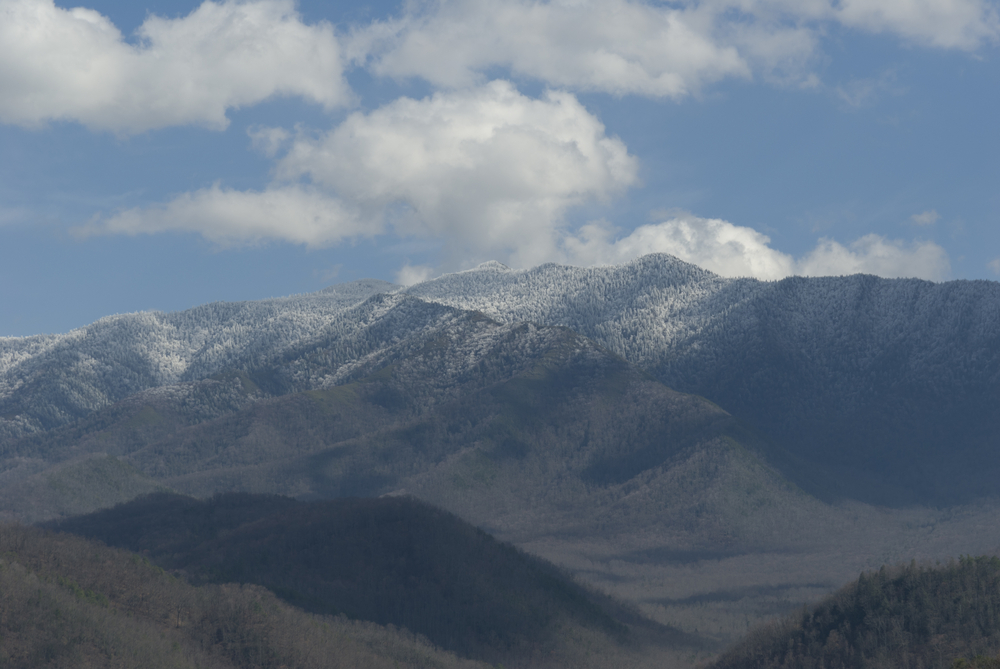
One of the most important things to consider when visiting and hiking Mt LeConte is the weather. Although the mountain is in a region that enjoys a mild climate with four distinct seasons, Mt LeConte weather conditions vary considerably depending on elevation and do not necessarily reflect the conditions of the city below due to the great difference in elevation. At 6,593 feet, Mt LeConte is the third highest peak in the Great Smoky Mountain National Park. When measured from its immediate base to its highest point, however, Mt LeConte is considered to be the tallest mountain in the entire Eastern United States, rising 5,301 feet from its base near Gatlinburg. While the mountain does experience seasonal weather changes, and there may be better times to plan a hike than others, Mt LeConte weather has a climate with cool summers and cold, snowy winters. The climate is significantly cooler and fairly wetter than Gatlinburg’s. The lowest temperature ever recorded was -32°F and the highest temperature recorded at Mt LeConte was 85°F. Month High Low Monthly Precipitation Monthly Snowfall Days of Precipitation Jan 35 19 7.0″ 18″ 12 Feb 35 18 8.2″ 20″ 12 March 39 24 8.2″ 26″ 12 April 49 34 6.5″ 5″ 10 May 57 43 6.0″ Trace Amounts 10 June 63 49 6.9″ 0 11 July 65 53 8.3″ 0 13 Aug 64 52 6.8″ 0 12 Sept 60 47 5.1″ Trace Amounts 8 Oct 53 38 5.4″ 2″ 8 Nov 42 28 6.4″ 5″ 9 Dec 37 21 7.3″ 8″ 10 Seasonal Mt LeConte Weather Spring – As with the surrounding area in lower elevations,...