About the Little River Road Driving Tour Originally an old railroad, this 18-mile Smoky Mountain driving tour runs from the Sugarlands Visitor Center to the Cades Cove Loop Road. A relatively slow-go, the Little River Road meanders alongside (you guessed it) Little River, passing at one point the exit to Townsend TN. Along the road, you will spot a variety of different natural and manmade structures. You’ll pass the trailhead to the Laurel Falls trail. About 10 miles into the drive, you’ll see the Metcalf Bottoms Picnic Area. If you’re able, you can stop and enjoy a picnic in the afternoon. You may even be able to see some wildlife during your afternoon picnic! From the picnic area, you can see the Little Greenbrier Schoolhouse. Once you get back on Little River Road, you’ll come up to the Townsend Y, a popular swimming hole for visitors and locals. Then, later on the road, you can make a stop at the Great Smoky Mountains Institute at Tremont. In addition to these great stopping points, this road shows you some of the best of the Great Smoky Mountains National Park. You can really see the beauty of the forest and mountainside and you also have a really great chance to see wildlife like the Smoky Mountain Black Bear. You can’t go wrong with this Smoky Mountain driving tour. Directions to Little River Road Auto Tour From Pigeon Forge, turn at traffic light #3 (Wears Valley Road). You’ll travel about 14 miles into Townsend. From Gatlinburg, travel about 2 miles south on South 441 to reach the Sugarlands Visitor Center. The, you’ll turn right onto...
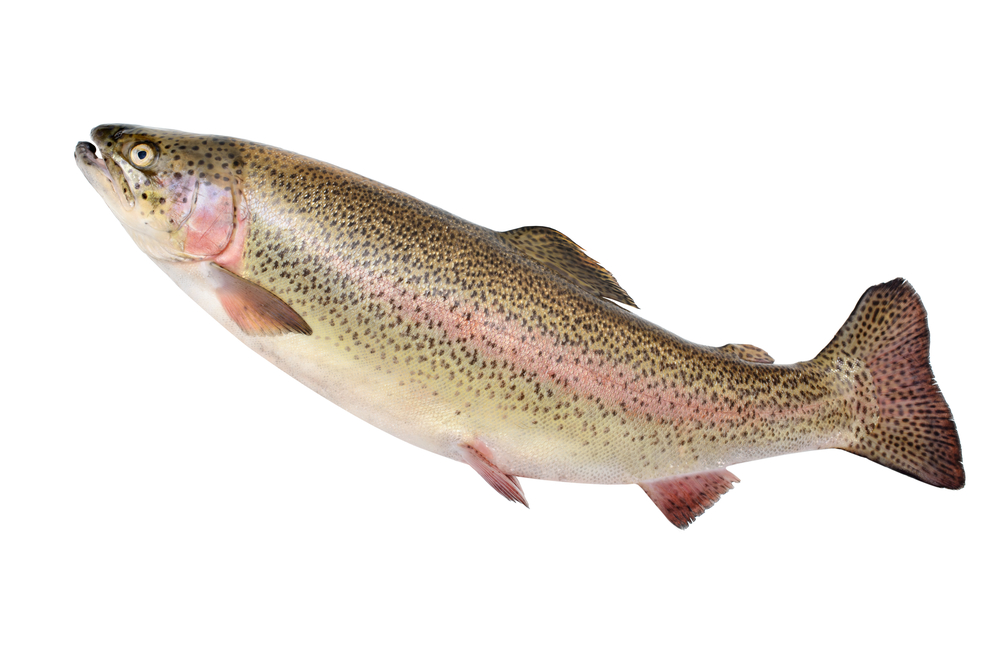
When people talk about trout fishing (particularly the novice), visions of the rainbow are evoked. The rainbow has been described as the “true American trout” because of it’s origins in the Pacific Northwest. This brings argument from scientific types who study such stuff, but most of us don’t care about things like that. Most of us think excitement when we think rainbow. The rainbow has spunk. They don’t stay with the stream bottom like brown trout, or hide in quiet backwaters like the brook. Rainbows are to be found in the open, faster waters, where they tend to feed at the surface more often than other trout. They are open, up front and honest, and for that reason we think more respectfully of them, and they are usually the most fun. While the North American rainbow trout is native to westward flowing Pacific Coast rivers, they have been introduced to many streams worldwide. Rainbows are the most easily cultured and adaptive of all trout and are thus included in most stocking programs. Rainbows had been introduced in forty-one states by 1900. Rainbow Trout Markings and Coloration Stream-living rainbows are easy to identify. Their upper bodies are heavily covered with black spots, a pattern that extends over the tail. Their backs range from light to dark olive, the abdomen is white and there’s a characteristic reddish pink band along the lateral line, a color that usually extends forward over the central portion of the fish’s gill covers. There are no red or yellow spots. As mentioned earlier, rainbows are the most adaptable of all trout and can tolerate a wider...
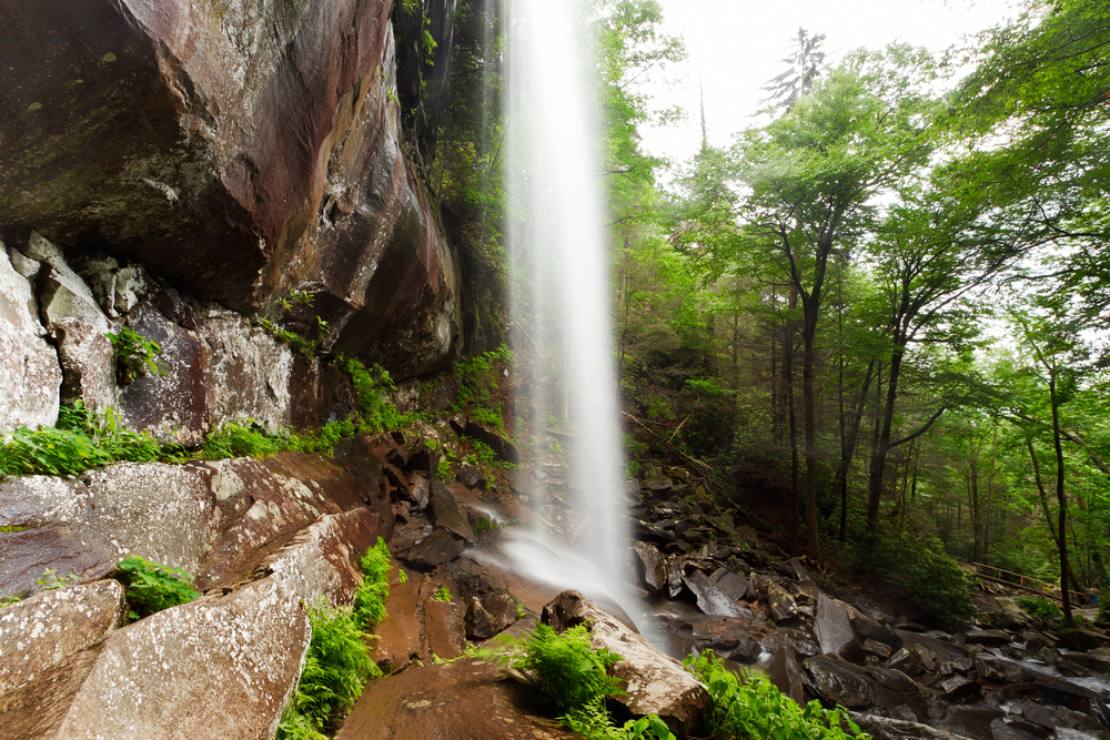
The Rainbow Falls Trail is one of several that will take you to the top of Mt. LeConte and is also the oldest or earliest route to LeConte. The trail can be challenging, but also offers an intermediate reward in that it affords the hiker a rest at the beautiful Rainbow Falls. Summary The Rainbow Falls Trail is fairly challenging if completed all the way to Mt LeConte. Allow an hour and a half to Rainbow Falls and four hours to Mt LeConte. Hikers will gain nearly 4,000 feet in elevation by the time they get to Mt. LeConte. Point of Departure Cherokee Orchard Road – Turn at light #8 in Gatlinburg and follow the Airport Road 1 mile out of Gatlinburg into the Great Smoky Mountains National Park. The name will change from Airport Road to Cherokee Orchard Road. About 2.5 miles after entering the Park, Cherokee Orchard Road approaches the Rainbow Falls parking area. You will find the trail head at one edge of the parking area. Features of Interest Your first reward comes at the 2.8 mile point when you arrive at Rainbow Falls. At the 6.6 mile point you will come upon an Alum Cave Trail junction which leads left 0.1 mile to the LeConte Lodge (the only lodging to be found within the Park), which is 6.7 miles from where you began. Overnights at LeConte Lodge require a reservation, which should be obtained weeks or even months in advance by calling (423) 429-5704. The Rainbow Falls Trail gains nearly four thousand feet in 6.7 miles, making it one of the more uniquely challenging climbs in...
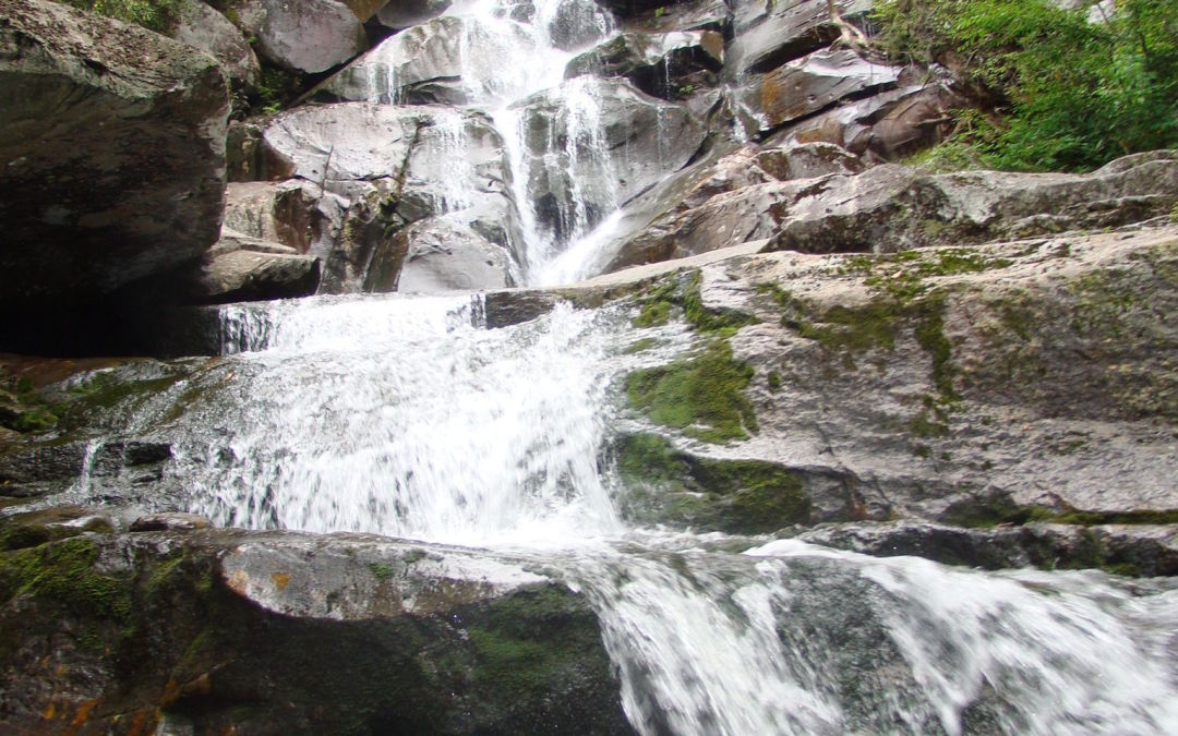
The rewards are great on this 8-mile round-trip hike in the Greenbrier section of the Park. The diligent hiker not only gets to enjoy the Ramsay Cascade falls—arguably the best waterfall in the Smokies—but also can view stands of old-growth trees which never suffered from the logger’s saw or the settler’s ax. Summary You have only to take this hike once to understand why it’s one of the most popular. The falls are ample reward not only for the hiker, but the artist and photographer as well. The trail starts out with a slight upgrade in the beginning, then becomes more challenging as you near the cascades. The latter portion of the trail is where you will find the old growth trees—some of which measure in record proportions. The round-trip is approximately 8 miles and can take a little over four hours, depending on whether you take children. Directions From Gatlinburg, drive east along US 321 (stop-light #3 in Gatlinburg) for approximately 6 miles. Turn right on Greenbrier Road and travel 3.1 miles along the Little Pigeon River to Greenbrier Cove. Turn left at Ramsay Prong Road and travel 1.5 miles to the parking area. The trail begins at the back of the parking area. Hike Details Your hike will start on the south side of the Middle Prong of the Little Pigeon River on the Ramsay Cascade Trail. You will cross the prong on a very long footbridge, and make your way past Ramsay Branch, which flows from Greenbrier Pinnacle on your left. At mile 1.5, the trail comes to a turnaround. The Greenbrier Pinnacle Trail turns off...
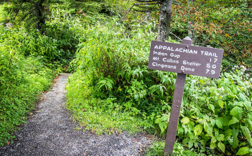
The Appalachian Trail meanders across the mountain tops of The Great Smoky Mountains National Park. Conceived in 1921 by Benton McKay and initially cleared and marked in 1923, the Appalachian Trail was completed in 1937 and is a marvelous tribute to the well-meaning individuals such as McKay who overcame many obstacles to create this splendid national treasure. The trail winds for 2,015 miles (actually it varies due to changes in sections of the trail) Appalachian Trail in the Great Smoky mountains through parts of 14 states. Its southern terminus is Springer, GA and ends (or begins, depending on your perspective) on Mount Katahdin in Maine. The Appalachian Trail in the Great Smoky Mountains The Trail (or AT as it is commonly called) includes a section 69 miles in length that serves as a boundary for Tennessee and North Carolina in the Great Smoky Mountains. A few hardy souls thru-hike the entire lengh of the AT each year (approximately 200 each year), but visitors to the Smokies can enjoy less challenging lengths of the Trail that are accessible from a few of the hiking trails that connect to the AT. One popular approach is to park at the Newfound Gap parking area (where you can also visit the memorial where Franklin D. Roosevelt dedicated the Great Smoky Mountains National Park). From the parking area, you can hike modest portions both north and south on the Trail. One popular destination is north to Charlies Bunion. From Charlies Bunion, fire clearings above steep mountain slopes afford spectacular views to peaks and valleys below. About every eight miles or so, the National Park...